CONTEC’s satellite image application and control system operation is designed to manage satellite imagery acquisition, processing, and distribution while providing efficient satellite control capabilities. Their integrated solution ensures precision operations, enhancing decision-making for various industries.
Here’s an overview of how the system operates:
- Satellite Image Acquisition
Tasking Satellites: CONTEC’s system allows operators to task satellites to capture images of specific areas. This can be done via user interfaces, where requests are submitted for real-time or scheduled imaging.
Automated Scheduling: The system optimizes imaging schedules based on satellite orbits, weather conditions, and user priorities. This ensures efficient use of satellite resources.
- Data Downlink and Ground Station Integration
Data Transmission: The imagery captured by satellites is transmitted via CONTEC’s global network of ground stations. This real-time communication ensures quick access to the data.
High-Speed Downlink: CONTEC’s ground stations provide high-speed downlink capabilities, enabling the system to handle large volumes of image data efficiently.
- Image Processing
Raw Data Processing: Once the imagery is downlinked, the raw data is processed to correct any distortions, noise, or errors that might have occurred during transmission.
Image Enhancement: The system enhances the quality of the images by adjusting contrast, resolution, and clarity, making the data more usable for analysis.
Geospatial Data Integration: Satellite images are often combined with geospatial data to provide more context and accuracy, enabling detailed mapping and analysis.
- Data Management and Distribution
Cloud-Based Storage: CONTEC integrates cloud storage solutions, allowing users to access satellite images from anywhere. This provides flexibility and scalability, especially for large datasets.
Data Security: The system ensures secure access to sensitive satellite data, often including encryption and role-based access control to safeguard the imagery.
User Access: Clients can access their satellite images through user-friendly dashboards or APIs, making it easy to download, visualize, and analyze the data.
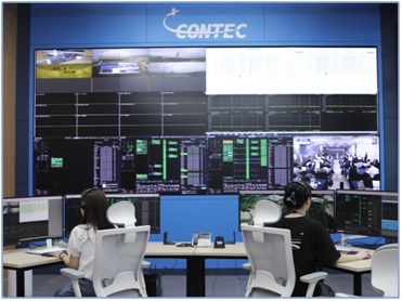
- Satellite Control System
Telemetry, Tracking, and Control (TT&C): The system enables real-time satellite control, allowing operators to monitor satellite status and health. It provides telemetry data to track satellite positions, fuel levels, and other key parameters.
Automated and Manual Commands: Operators can send commands to adjust the satellite’s orbit, change its imaging settings, or troubleshoot any issues. Both automated and manual controls are available.
Fault Detection and Management: The control system continuously monitors the satellite for any anomalies and can trigger alerts or initiate corrective actions.
- Applications of Satellite Imagery
Earth Observation: Satellite images are used for a variety of applications, including land monitoring, urban planning, and environmental studies.
Disaster Management: Imagery can be used to assess damage from natural disasters like floods, earthquakes, and wildfires, helping with response and recovery.
Agriculture: Farmers and agricultural businesses use satellite imagery to monitor crop health, soil conditions, and yield predictions.
Defense and Security: Governments use satellite imagery for surveillance, border monitoring, and defense operations.
If you are looking for a satellite control system operation and image application, you can find them at CONTEC.
Click here to contact CONTEC
View more: Satellite Image Application and Control System Operation